Goodnight Raleigh - a look at the art, architecture, history, and people of the city at night

Reminiscences of a Raleigh Boy, Part 3: Fayetteville Street

Part 3: Raleigh’s Main Street

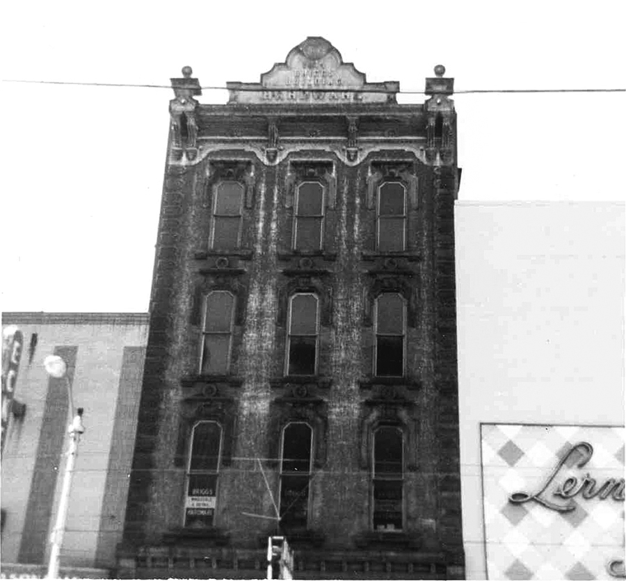
Briggs Hardware (1874) on Fayetteville Street in 1965

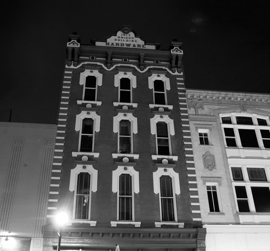
Briggs Hardware 2008, now home of the City History Museum. Next door is the former Boylan Pearce department store with its recently restored Beaux Arts facade.

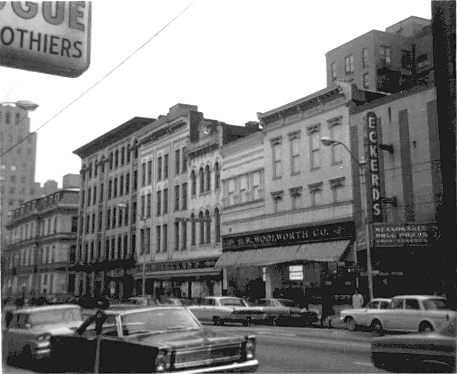
200 block of Fayetteville St showing the Tucker Building and the Post Office on the left

200 block in 2008

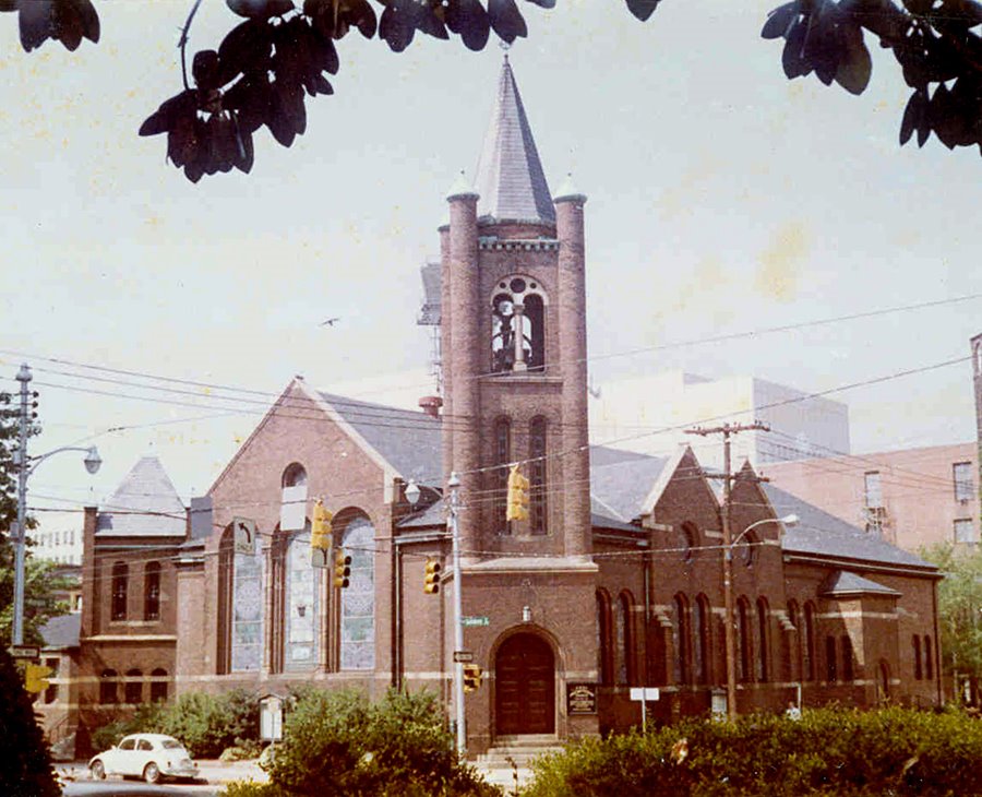
View toward the Capitol from the 100 block, 1966. With the exception of the two state government buildings at the end, all the structures in this view are gone.

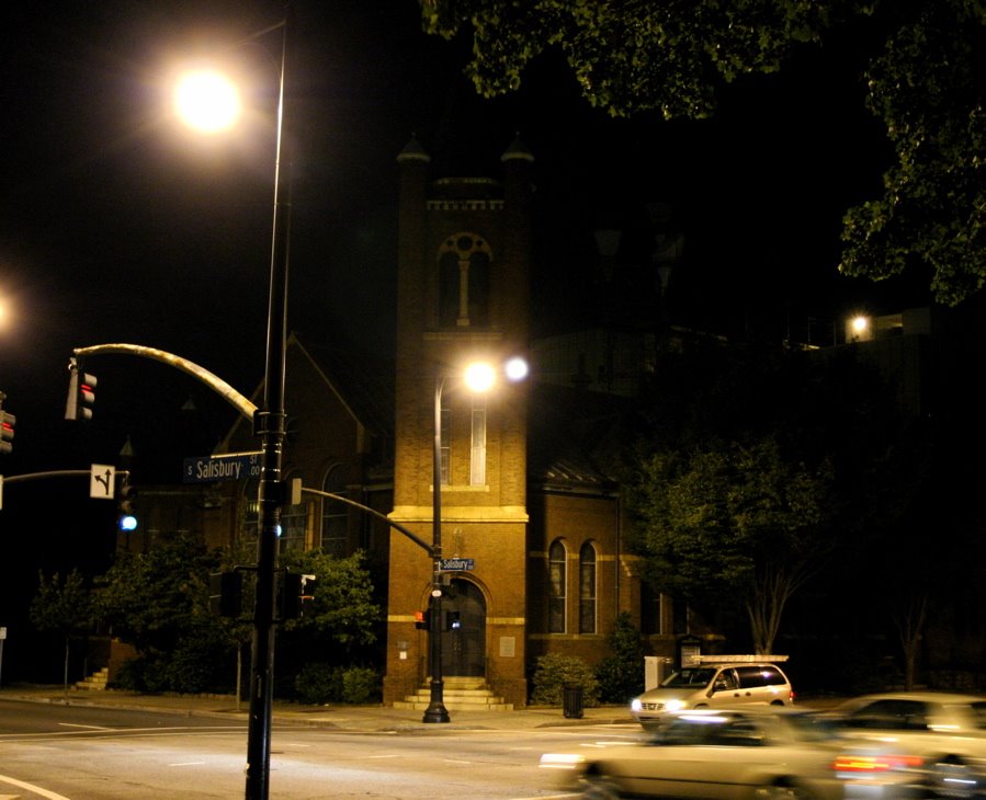
In 2008; Looks beautiful at night, doesn’t it?

Close up of east side of the street in the 1966 view.
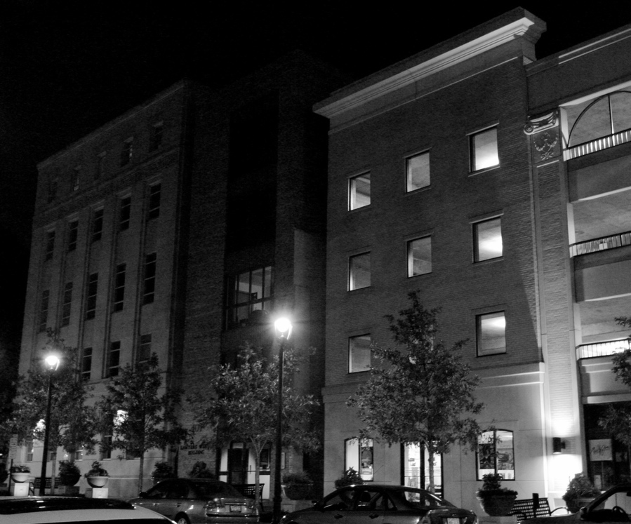
Last night.

fayetteville4_60s

View toward the 200 block from the alley between the (old) Wachovia building on the right and “Lenin’s Tomb” on the left.

The view today. The alley was closed during the mall period.


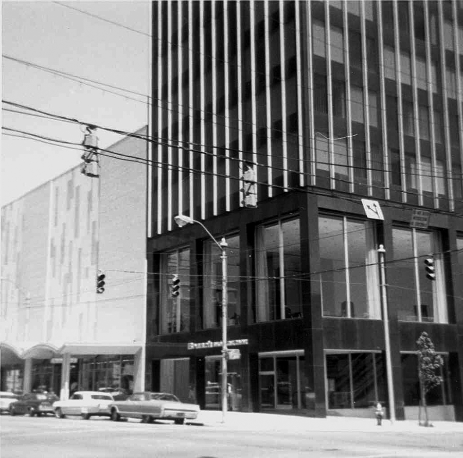
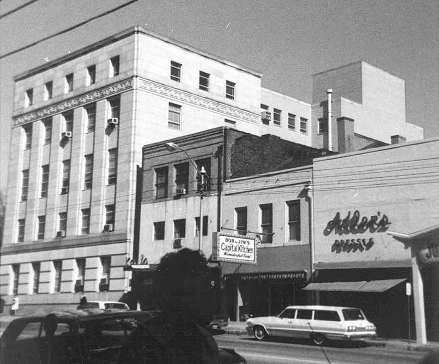
The lower floors of ” Raleigh’s Little Seagram Building” and the 1960s facade of Hudson Belk.
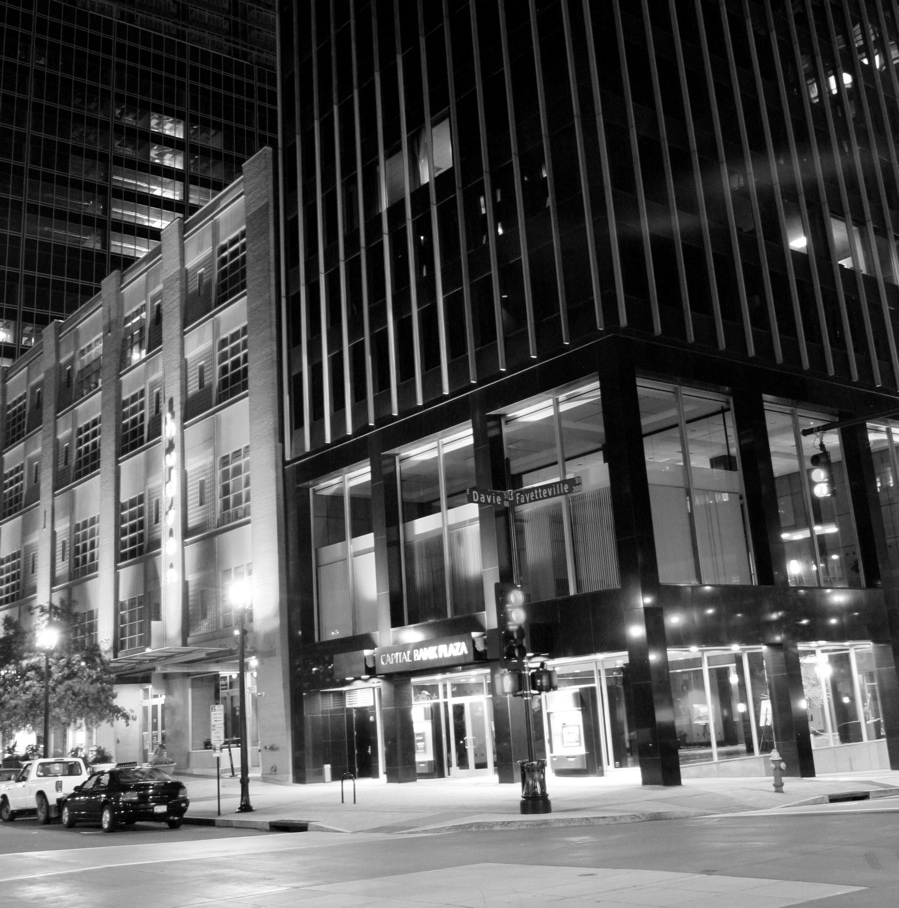
Same view today.

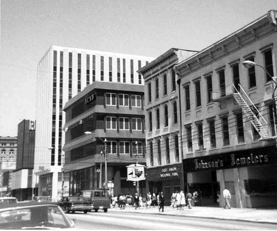
The east side of the 200 and 300 blocks in 1966 showing the (old) Wachovia building, “Lenin’s Tomb” and the block of 19th century storefronts where the RBC building is now going up.


If Capitol Square was the hub of Raleigh, then Fayetteville Street was its strongest spoke. For most of its existence and well into the 20th century this broad thoroughfare was the commercial and governmental axis of the city. Along its course were Raleigh’s principal businesses, hotels, banks, office buildings and government centers.

Read more »

The Boylan Wye: Why The Wye?


Next time you are up on the Boylan Ave. Bridge, or on the deck of the Boylan Bridge Brewpub, taking in the view of Raleigh’s ever-growing skyline, cast your eyes downward and you will see the skeletal remains of part of Raleigh’s industrial past.
Just where the CSX and Southern RR tracks emerge from under the bridge is the Boylan Wye. At this point the tracks diverge, forming a Y shape, or “wye.” It’s hard to imagine now, but this area was once a hub of some of Raleigh’s railroad-related industries.
Booming from about 1900 into the 1950s, the wye was the locale of several coal yards, ice plants and iron works. At one time a mattress factory was here, and later a concrete plant. These businesses all used the the wye as a switching yard and as a means to move freight in and out. Passenger trains also used the wye to back in and out of the Union Station, then located two blocks away on Nash Square.
Nowadays all the hubbub is gone. You can still find remnants of the coal yards and the concrete plant, and there’s even the concrete foundation of a turntable down there.
As the images of Raleigh’s railroad history pass from thought, your eyes cast upward now, taking you back into the 21st century.

Reminiscences of a Raleigh Boy, Part 2: Capitol Square

The Center of Town


The Capitol from Hillsboro St. in 1965.


Same view today.


First Presbyterian about 1968.


Same view at night today.

Capitol Square (or, more properly, Union Square) has been both the geographical and political center of downtown Raleigh ever since the city was surveyed and laid out by William Christmas in 1792. With the massive Capitol building at its center, the square is anchored at its four corners by four imposing church buildings. Encircling the square are various somber stone and brick state government buildings, many of which are fine examples of the particular architectural period during which they were built. The first of these to be built, in 1888, was the Supreme Court building (now Labor); the last, the Museum of History in the 1990s.

Read more »